看板 CityNight
作者 標題 [筆記] note Google Search: 地質 礦物 地球科學 環境
時間 2015-12-31 Thu. 09:22:37
[筆記] note Google Search: 地質 板塊 陸塊 海洋大陸 火山 礦物 地球科學 環境 地形 大洋洲
https://en.wikipedia.org/wiki/Craton
"陸塊" "地塊" "板塊" "盾地" "克拉通"
※ 編輯: Ctea 時間: 2015-06-15 00:40:19
Moved from: disp.cc/b/261-8KP4
http://www.niotv.com/epg_content.php?content_id=21800
世界海洋日特輯(NGC) (Ocean Day) [知性] - nio電視網
為慶祝世界海洋日,國家地理頻道精選一系列特輯,讓觀眾更了解我們居住的這個藍色星球。地球上有百分之七十的面積為海洋,居住在這個星球上的人類,更應好好珍惜我們的環境,了解海洋當前面對的環境威脅,才能共同為維護環境而努力。
失落的太平洋大陸 Lost Continent of The Pacific
不管是在哪個時代,失落文明的傳說總令人心神嚮往。在大發現年代,探險家在太平洋四處尋找未知的領土,卻沒有成果。直到今日,復活節島上的老人聲稱祖先來自一處名為希瓦的大陸,這座大陸在災難發生後沉入海裡。現在新的科學證據指出玻里尼西亞一處偏遠群島,可能就是古老繁榮文明的中心,四百多年來這些島嶼被稱為馬克沙斯群島,但在那之前玻里尼西亞人稱它們為希瓦群島,這是否就是失落的希瓦大陸?本節目使用新的考古與地質證據,加上流傳幾世紀的口述傳統與航海技術,即將解開失落的太平洋大陸之謎:這是海洋與探險的世界,活人獻祭與傳奇海上探險家的世界,這些探險家早在哥倫布發現新大陸的幾百年前,就航行越過世上最大的海洋。
打開海洋百寶箱 Light the Ocean
本節目以全新的觀點探索海洋世界,結合世界各地科學家所提供的資料,以及特別設計的電腦動畫軟體,我們把海水變得清澈無比,揭露壯觀海底景觀以及隱藏結構,說明景觀與海水如何以難以想像的規模互動,創造出跟陸地棲息地同樣多元性的海洋世界。同時,我們的攝影團隊走遍世界各地,造訪南極與中大西洋深海區,拍攝多采多姿的生物。
透視北美五大湖 Drain the Great Lakes
北美洲的五大湖是世上最大的淡水系統,對北美大陸具極大影響力。超過三千四百萬人住在湖邊的世界級大城市裡。這個劃時代的電視節目以虛擬手法讓湖水流乾,利用電腦影像顯現湖底的人類歷史和不斷演進的地質變化。
詹姆斯柯麥隆-地心探險 James Cameron: Voyage To The Bottom of The Earth
進入從未人知的馬里亞納海溝.,詹姆斯柯麥隆的深海挑戰大探險讓這位國家地理頻道險家來到從未有人踏足的地方,終點線在海底約36000呎深,壓力到達每一平方吋16000磅。現在請聽他講述前往地底探險的過程,體驗令人緊張的時刻並且一窺專業旅行家的思緒!
挑戰馬里亞納海溝 Deepest Dive: The Story of Trieste
50年前,有兩名男子試圖前往海洋的最深處:南太平洋的馬里亞納海溝底部。此地深達35,800呎,有「挑戰者深淵」之稱。本節目藉由晚近發現的素材影片、錄音、原始訪問紀錄和動畫,訴說瑞士海洋學家雅克皮卡德與美國海軍中尉唐華許,搭乘深潛艇「第里雅斯特號」探索挑戰者深淵的故事。這項壯舉至今仍無人能及。
= 分隔線 =
http://phyllischan.blogspot.tw/2009/06/blog-post_02.html
失落的古大陸文明 - phyllis productions
亞特蘭提斯
姆大陸
雷姆利亞大陸
※ 編輯: Ctea 時間: 2015-06-22 17:29:39
https://en.wikipedia.org/wiki/Plate_tectonics
Plate tectonics
https://en.wikipedia.org/wiki/Lost_lands
Lost lands - Wikipedia, the free encyclopedia
https://en.wikipedia.org/wiki/Submerged_continent
淹沒的大陸
https://en.wikipedia.org/wiki/Template:Submerged_landmasses
* Added by 202403252005
https://en.wikipedia.org/wiki/Continental_fragment
大陸碎片(微大陸) Continental fragment (Microcontinent)
https://en.wikipedia.org/wiki/Template:Tectonic_plates
https://en.wikipedia.org/wiki/Phantom_island
幽靈島(失落的島嶼)
https://en.wikipedia.org/wiki/Doggerland #北海
#英國 #北歐 #德國 #不列顛群島與歐洲大陸連結 #泰晤士河Thames #萊茵河Rhine
https://en.wikipedia.org/wiki/Alpide_belt
Alpide belt 阿爾卑斯帶 地中海-喜馬拉雅山火山地震帶
https://en.wikipedia.org/wiki/Ring_of_Fire
火環
https://en.wikipedia.org/wiki/Subduction
隱沒帶
https://en.wikipedia.org/wiki/Hydrothermal_vent#Black_smokers_and_white_smokers
Black Smoke
https://en.wikipedia.org/wiki/Shoal
沙灣
https://en.wikipedia.org/wiki/Mount_Shasta
Mount Shasta
#休火山
瑤諾島
閣遙島
https://commons.wikimedia.org/wiki/File:Aragonite_in_tube.JPG
Aragonite in tube
霰石
via https://en.wikipedia.org/wiki/Biorock
#電鍍 電積 #生物岩Biorock
--
※ 作者: Ctea 時間: 2015-12-31 09:22:37
http://volcano.gl.ntu.edu.tw/class/chapter4-1.htm
火成岩的種類
[PDF] 台灣的火成岩及火成作用
http://basin.earth.ncu.edu.tw/downlo...黃文正- 台灣的火山活動與火成岩_2012final.pdf
安山岩 火成 - Google 搜尋
※ 作者: Ctea 時間: 2015-12-24 13:34:21
※ 編輯: Ctea 時間: 2016-01-08 11:17:12
https://commons.wikimedia.org/wiki/File:Algérie_2009.jpg
自然風化作用雕塑出的沙漠岩山
※ 編輯: Ctea 時間: 2016-01-08 11:48:30
http://terms.naer.edu.tw/detail/1023327/?index=10
附屬岩脈
satellite dike
※ 編輯: Ctea 時間: 2016-01-08 17:59:04
※ 編輯: Ctea 時間: 2016-01-22 10:36:13
satellite dike - Google 搜尋
#地質學 #附屬岩脈
https://en.wikipedia.org/wiki/Molasse
https://en.wikipedia.org/wiki/Molasses
https://en.wikipedia.org/wiki/Yomari
#磨礫石 #尼泊爾甜點 #糖蜜 #糕點
※ 編輯: Ctea 時間: 2015-09-25 18:55:57
※ 編輯: Ctea 時間: 2016-03-18 15:26:20
※ 編輯: Ctea 時間: 2016-06-14 16:29:16, 16:30:17
https://en.wikipedia.org/wiki/Pangaea
https://commons.wikimedia.org/wiki/File:Gondwana_fossil_map_ger.png
https://commons.wikimedia.org/wiki/File:Snider-Pellegrini_Wegener_fossil_map.svg
#大陸飄移 #化石證據 #拼圖 #南極 #非洲 #南美洲 #澳洲 #印度
https://en.wikipedia.org/wiki/Lemuria
Lemuria 狐猴大陸
Some Tamil writers such as Devaneya Pavanar have associated Lemuria with Kumari Kandam, a legendary sunken landmass mentioned in the Tamil literature, claiming that it was the cradle of civilization.
https://en.wikipedia.org/wiki/Kumari_Kandam
In the 19th century, some European and American scholars speculated the existence of a submerged continent called Lemuria to explain geological and other similarities between Africa, Australia, the Indian subcontinent and Madagascar. A section of Tamil revivalists adapted this theory, connecting it to the Pandyan legends of lands lost to the ocean, as described in ancient Tamil and Sanskrit literature. According to these writers, an ancient Tamil civilisation existed on Lemuria, before it was lost to the sea in a catastrophe.
https://www.google.com.tw/search?q=l...s7s0WUE=#imgrc=Q6g2J8FKuqMPZM:
https://en.wikipedia.org/wiki/Mauritia_(microcontinent)
https://commons.wikimedia.org/wiki/File:Early_Jurassic_breakup_of_Gondwana.png
https://commons.wikimedia.org/wiki/File:Gondwana_breakup.png
https://en.wikipedia.org/wiki/Seychelles_microcontinent
Seychelles microcontinent
https://en.wikipedia.org/wiki/Detrital_zircon_geochronology
Detrital zircon geochronology
Early Jurassic breakup of Gondwana (left/above) and A. Early Cretaceous, B. Late Cretaceous, C. Paleocene, D. present day (right/below)
#剛杜瓦納 #板塊分裂 #zircon鋯石 #年代鑑定
https://en.wikipedia.org/wiki/Mu_(mythical_lost_continent)
Mu 穆大陸
https://www.google.com.tw/search?q=l...Qoe5MVM=#imgrc=kNskmsilxEy5qM:
假想大陸 + 古文明
https://hiddenincatours.com/lost-pacific-continent-of-mu-or-lemuria-what-is-the-evidence/
http://fractalenlightenment.com/3504...eories-of-atlantis-and-lemuria
via
http://www.abovetopsecret.com/forum/thread329953/pg1
via
※ 編輯: Ctea 時間: 2016-06-14 16:07:47, 16:08:22, 16:32:39
https://en.wikipedia.org/wiki/Mount_Shasta
https://commons.wikimedia.org/wiki/File:Sunrise_on_Mount_Shasta.jpg
#攝影
※ 編輯: Ctea 時間: 2016-06-14 16:36:34
https://www.plurk.com/p/m3f1ay
https://en.wikipedia.org/wiki/Zealandia
https://en.wikipedia.org/w/index.php...=765928523&oldid=765901846
下午 02:50 2017/2/17
http://www.sciencedirect.com/science/article/pii/0012821X91900983
Sediment loading on the Western Platform of the New Zealand continent: Implications for the strength of a continental margin
#紐西蘭大陸
https://www.theguardian.com/world/20...474966&CMP=EMCNEWEML6619I2
Zealandia – pieces finally falling together for continent we didn't know we had
https://www.geosociety.org/gsatoday/archive/27/3/article/GSATG321A.1.htm#toclink5
GSA Today - Zealandia: Earth’s Hidden Continent
※ 編輯: Ctea 時間: 2016-07-01 09:43:38
※ 編輯: Ctea 時間: 2016-12-22 17:29:48
※ 編輯: Ctea 時間: 2017-02-17 16:09:36
※ 編輯: Ctea 時間: 2017-02-18 12:04:40
https://www.google.com.tw/search?q=g...p;sourceid=chrome&ie=UTF-8
https://en.wikipedia.org/wiki/List_of_fault_zones
List of fault zones
#全球斷層帶
※ 編輯: Ctea 時間: 2018-01-15 01:54:52
https://en.wikipedia.org/wiki/Anatolian_Plate
Anatolian Plate
※ 編輯: Ctea 時間: 2018-01-15 01:56:29
https://www.google.com.tw/maps/@-41.538519,175.6619785,3139874m/data=!3m1!1e3
西蘭大陸(Zealandia)
https://www.google.com.tw/maps/@-55.817963,76.7371315,2962177m/data=!3m1!1e3
凱爾蓋朗海台
https://www.google.com.tw/maps/@-0.2812669,111.1548698,2822266m/data=!3m1!1e3
巽他古陸
Dogger Land
過去:https://commons.wikimedia.org/wiki/F...a.org/wiki/File:Doggerland.svg
現在:https://commons.wikimedia.org/wiki/F...a.org/wiki/File:Doggerbank.jpg
漁民撈到的:https://en.wikipedia.org/wiki/File:200805231215_Wollhaarmammut_Millie_Schädel.jpeg?https://en.wikipedia.org/wiki/File:200805231215_Wollhaarmammut_Millie_Schädel.jpeg
※ 編輯: Ctea 時間: 2018-04-05 23:54:02
※ 編輯: Ctea 時間: 2018-05-08 22:39:31
※ 編輯: Ctea 時間: 2018-05-08 22:42:18
https://www.theguardian.com/science/...474966&CMP=EMCNEWEML6619I2
Mystery of sea nomads' amazing ability to freedive is solved
Scientists have uncovered the secrets of the Bajau people, long-famed for their ability to hold their breath for extraordinary lengths of time
#航海 #自由潛水 #憋氣
※ 編輯: Ctea 時間: 2018-05-18 16:46:40
https://www.bbc.com/ukchina/trad/ver...gascars-bizzare-natural-wonder
風琴管:馬達加斯加的自然奇觀
※ 編輯: Ctea 時間: 2018-12-03 17:38:53
https://www.nationalgeographic.com/t...ls-yellowstone-live-chp3::rid=
Watch Yellowstone Live on National Geographic
#國家地理 #黃石公園
※ 編輯: Ctea 時間: 2019-06-28 01:11:02
https://www.msn.com/en-gb/lifestyle/...m-hawaii-to-iceland/ss-BBNe3zR
For the crater good! The world's most jaw-dropping volcanic landscapes revealed, from Hawaii to Iceland
#夏威夷 #冰島 #火山
※ 編輯: Ctea 時間: 2019-07-11 23:20:59
> -------------------------------------------------------------------------- <
[= #大洋洲 #海洋大陸 #海之大陸 #南島民族 #南島語族
http://www.niotv.com/epg_content.php?content_id=21800
世界海洋日特輯(NGC) (Ocean Day) [知性] - nio電視網
失落的太平洋大陸 Lost Continent of The Pacific
不管是在哪個時代,失落文明的傳說總令人心神嚮往。在大發現年代,探險家在太平洋四處尋找未知的領土,卻沒有成果。直到今日,復活節島上的老人聲稱祖先來自一處名為希瓦的大陸,這座大陸在災難發生後沉入海裡。現在新的科學證據指出玻里尼西亞一處偏遠群島,可能就是古老繁榮文明的中心,四百多年來這些島嶼被稱為馬克沙斯群島,但在那之前玻里尼西亞人稱它們為希瓦群島,這是否就是失落的希瓦大陸?本節目使用新的考古與地質證據,加上流傳幾世紀的口述傳統與航海技術,即將解開失落的太平洋大陸之謎:這是海洋與探險的世界,活人獻祭與傳奇海上探險家的世界,這些探險家早在哥倫布發現新大陸的幾百年前,就航行越過世上最大的海洋。
#海洋大陸
※ 編輯: Ctea 時間: 2015-06-22 17:29:39
http://jfkeep.pixnet.net/blog/post/28190895
失落的太平洋大陸。波里尼西亞群島。航海 @ 先見之明的預兆
https://www.google.com.tw/search?q="...ome&es_sm=122&ie=UTF-8
"太平洋大陸" "國家地理頻道" - Google 搜尋
※ 編輯: Ctea 時間: 2015-12-31 09:22:37
https://youtu.be/bjEflVWEq44

http://jfkeep.pixnet.net/blog/post/28190895-失落的太平洋大陸。波里尼西亞群島。航海
復活節島上的居民,到底是從何而來?他們到處拜訪島上的老人們、打聽這座島上的傳說和歷史、並檢驗他們的血統DNA,因為藉由DNA,就能夠明白他們會和哪些地方的人有關連。
島上的居民們說,他們的祖先是從「希瓦大陸」來的。
四處探查之後,得知「希瓦大陸」是古名,現在稱為「馬克沙斯島」,這在復活節島的西北方三千多公里遠的位置。
=
在馬克沙斯島,有另一批考古學者正在挖掘著遠古的遺物。這些學者對馬克沙斯島做了簡單的歷史介紹:馬克沙斯島為波里尼西亞群島之一。19世紀時,歐州人對馬克沙斯島已有紀錄,形容該島是一個危險的島嶼。
的確,從島上的研究中發現,這裡過去住的是食人族,會進行活人獻祭(獻祭的活人是隨便亂抓來的),而首長和祭司會吃人肉,這並非是他們想吃人肉,單純只是因為吃人肉是活人獻祭的儀式。
馬克沙斯島中有一個叫維塔湖的地方,學者推測此地以前的人口很多。從遺跡推斷,石頭的大小和牆面的高低,能代表它主人生前的地位與權勢。比如說房子越大,主人越有錢;但那其實也不算是房子,而只是一坐高台。
當時的刺青,是用熟堅果的粉。
在當地還發現更多的遺跡、大型石象和石雕象,都和復活節島上的巨石象很類似。馬克沙斯島是除了復活節島之外,唯一有類似大型石象的地方。
馬克沙斯島上的科學家想證明一個假設:「古波里尼西亞人是有意識地進行渡海貿易和殖民的行為。」(早期的科學家則認為他們只是意外才渡海的。)
這些科學家在馬克沙斯島上,首先挖到了「珍珠貝魚鉤」。從土壤的成份、地質深度,可以研判這是多久之前的物品。
珍珠貝並不屬於馬克沙斯島上的產物,因為珍珠貝只能生長於瀉湖中,但馬克沙斯島上並沒有瀉湖,而離此地最近的珍珠貝產地在距離此地一千公里外的土木土群島。
不過,若要證明他們在千年前就有航海貿易,則還需要有更多的證據。
接著他們挖到了「石製扁斧」。當地的島上也不產這種石頭。過去也有人為了研究這石頭到底是產自何處,不過都找不到答案。為了了解這種石頭究竟從哪裡來,他們打聽到了「伊奧島」,但這個島對波里尼西亞人來說是一個不祥之地。
研究團隊帶著足夠份量的食物和水前往該地。直升機和他們相約五天後見,並把他們丟在這坐伊奧島上了。找了四天多,完全都沒找到古人曾在這裡製作石斧的遺跡,也沒找到這種石材。(他們這四天也完全沒洗澡,又累又餓又渴)
直到了第五天,要搭上直升機的一個小時前,在用刀從草叢劈出一條路的時候,偶然發現了一個遠古的工作坊。他們從這工作坊帶走了一些石片回去做研究。經過火山學家的高科技分析儀器的證明伊奧島上的石頭和馬克沙斯島上的扁斧使用了同一種石頭作為材料。他們
稱這種石頭的原石叫「核心」,為製作扁斧的主材料。
這伊奧島,也和馬克沙斯島距離很遠!
更奇妙的是不只有馬克沙斯島上有這種石斧。在整個波里尼西亞群島,直至大溪地,都有這種石斧。這石斧可以證明當時的人們便已有很長遠的國際貿易,且為一條雙向的國際航線。
=
「部落間的戰爭,失敗的人帶著自已的部族逃亡而發現了新島嶼。」
在從復活節島上口耳相傳的傳說中,是一位名叫霍都馬杜的人帶領他們祖先到這裡的。(當時沒有文字能夠記載,因此都靠口耳相傳。)
根據傳說,他們在希瓦大陸的領土爭奪中失利之後逃亡,便來到了復活節島。
=
「珍珠貝魚鉤」和「石製扁斧」證明了當時一定有航海貿易,研究團隊接下來要證明當時的獨木舟是否有辦法進行超長距離的遠航。
由於現代並沒有遺留下當時的船隻,而造船的專家也是靠著島民的口頭描述來仿造出當時船隻,而且這並與我們想像中的獨木舟不一樣,比較像是由二條獨木舟從中間連結架起來,形成「目」字形的大船。這一條船至少能夠給12個人乘坐。船的形狀很像椰子葉,兩端往
上翹,底部是平的。船身選用烏魯樹,這種木材又輕又防水。
經過實驗,造船者證明這種船的確具有遠航的能力有能力,也很適合遠航。不過,現在有了船,那人們便有了能夠遠航的能力嗎?因為長時間住在獨木舟上是很危險的,除了食物不足之外,若沒下雨則會使得飲用水不足,而釣魚也很容易釣到鯊魚。
畢竟太平洋占了地球的表面三分之一,要在這一大片海洋上長時間、長距離的航行,可不是開玩笑的。
不過,後來發現其實這個區域有很多小島,古代都稱之為「希瓦」。所以希瓦島可能為群島,而不是單一的一座島。
科學家認為,古人是有意航海,而非意外的渡海。
古代有一種叫「陰陽線圖海洋圖」的東西,能夠判定方位以得知各島嶼間的方向。這個陰陽線航海圖是用椰子葉和貝殼製作的:以貝殼代表島嶼,椰子葉則是海流與航線。
這地圖,看起來很好玩。
=
這裡的海風是熱帶海風,幾乎都是由東向西吹,亦稱「信風」。一年中只有在某些特別的日子,風才會從西方吹過來,但為期不長,稱之為「西風」。古代的水手們都知道西風。古波里尼西亞人可能就是選在一年之中短短的這幾天來進行航行。
由於當時並沒有羅盤,究竟人們是如何能夠在茫茫大海上航行?科學家認為,人天生就有方向感,如觀星技巧。
因為過去並沒有文字作為紀錄的方式,古人的觀星導航技術也是靠口耳承傳下來的。有一位名叫湯普森的科學家兼冒險家從一位當地的島民‧莫大師學到了這項觀星導航的技能。莫大師是世界上僅有少數幾位懂得觀星航海術的人士,但很遺憾的,這位莫大師在拍攝影片
的當時過世了。
湯普森召集了一批年輕的冒險家,以觀星導航的方式,在沒有羅盤的情況之下展開了遠航。他們的航線是這樣的:向大溪地前進,中途轉向夏威夷後回家。
湯普森團隊靠的是當地最常用來判別方向的星座:天蠍座。
天蠍座中有三顆星,只要是垂直出現在海平面上,那就是他們所要前進的方向;如果這三顆星不是垂直的直線,就代表他們的方向歪了,需要進行調整。
在這段航程中,夜晚的星星是他們唯一的工具,只有在夜晚才能靠著星星來判別方向,但是夜晚同時也是危險性很高的時候。
湯普森說:「決定做了,就得繼續向前!」除非再等到下個日出或日落,你才能再度調整方向。這段旅程一共花了他們6週的時間才抵達目的地。他們非常配服古人的「韌性、勇敢、能力」。
(講到這段航海,我就想到《藏地密碼》的冥河之路:前從聖地香巴拉有二條路,卓木強他們選擇走冥河之路,莫金他們則是走另一條。)
(觀星判別方向,其實在《牧羊少年奇幻之旅中》也有提到。他們在茫茫的沙漠上前進,靠的就是星星來決定方向。沙漠和大海很像,也是一望無際。其實沙漠也是大海,因為沙漠曾經就是一片大海。)
=
種種實驗與證據都證明了古波里尼西亞人已經開始從事遠航貿易。
那麼,他們可能比哥倫布還要早好幾百年來到南美洲嗎?
復活節島上的血統DNA分析,證明了復活節島上的人的確是與波里尼西亞人同一個血脈,其中還有更特別的發現:他們的血流中,還有南美州人的DNA。
在馬克沙斯島上,除了珠珍貝魚鉤、扁斧之外,還發現了「炭化番薯」,這也並不是當地的原生產物。(不過當地現今已很頻繁的種植番薯。)
不同於可以隨海飄流的椰子,若番薯掉到海中,肯定就死掉了,因此番薯是經過貿易行為所帶來的。而番薯,其實是南美洲的產物,也就是說可能是有人跑去了南美洲,並把番薯帶到了波里尼西亞群島。
科學家們進一步推測:相較於美國人、歐洲人,他們會把他們所身處的土地當作是他們的家園。
那麼波里尼西亞人,他們也可能把他們身處的這片大海當作是他們的家園。
=
這是一片廣大的區域,這一片廣大三角形是:
以希瓦島為中央,
往上直到夏威夷,
往左下到紐西蘭,
往右下到復活節島。
這三個點所連接成的一大片三角形。這二萬五千多平方公里是人類最大的文化領土,也是世界上的第三大洲。
#番薯 #地瓜 #南島
※ 編輯: Ctea 時間: 2016-06-14 16:45:38, 16:49:22, 18:33:01
※ 編輯: Ctea 時間: 2016-06-15 15:03:08
> https://www.plurk.com/p/loi5w5 迪斯奈第一位南太平洋公主的汪洋冒險《Moana》前導預告
> https://www.plurk.com/p/lyvekc 《海洋奇緣》 是對玻里尼西亞的讚歌、革新象徵 ── 抑或是迪斯奈犯下的另一個文化蠢事
https://www.ptt.cc/bbs/movie/M.1489332781.A.92C.html
[討論] 海洋奇緣的女神 - 看板 movie - 批踢踢實業坊
剛才看完海洋奇緣 忽然領悟到 塔菲緹女神其實是在台灣啊!! 主角們是從大洋洲度過太平洋來到了台灣 而女神橫躺著
剛才看完海洋奇緣 忽然領悟到 塔菲緹女神其實是在台灣啊!! 主角們是從大洋洲度過太平洋來到了台灣 而女神橫躺著
https://www.matataiwan.com/2017/02/06/story-behinds-moana/
《海洋奇緣》浪漫神話背後是一段人類未解的失落歷史──我們為何不再遠洋了? | Mata Taiwan
![[圖]]() 到底是什麼原因會使得人們忘卻了親近大海的能力?在還未上映時即引發熱議的迪士尼動畫電影《海洋奇緣》(Moana),就是因為這樣的疑問激起導演的靈感,進而促成這部作品的誕生。 解釋 3,500 年前人類遷徙謎團的動畫 臺灣觀眾或許隱約地聯想到,這部片所描述的人群和我們原住民族一樣同屬南島語族,卻 ...
到底是什麼原因會使得人們忘卻了親近大海的能力?在還未上映時即引發熱議的迪士尼動畫電影《海洋奇緣》(Moana),就是因為這樣的疑問激起導演的靈感,進而促成這部作品的誕生。 解釋 3,500 年前人類遷徙謎團的動畫 臺灣觀眾或許隱約地聯想到,這部片所描述的人群和我們原住民族一樣同屬南島語族,卻 ...
![[圖]](https://www.matataiwan.com/wp-content/uploads/2017/02/31430615560_7d38257179_b.jpg)
https://theinitium.com/article/20170217-opinion-linhaoli-moana/
在南島語區的不同地方,可以找到 Hina 的同源字──例如阿美語就有ina 一詞,代表母親、阿姨。而莫娜在「海洋奇緣」中母親的名字 Sina,正是 Hina 的一種變體,但她在電影中卻沒有什麼存在感。這顯示迪士尼知道這個神話邏輯,卻選擇將之邊緣化。 說到性別,影片倒是有些值得肯定的設定。
例如,結尾安排岩漿怪物提卡(Te Kā)轉化成大地之母塔菲提(Te Fiti),倒是頗值得讚賞。火山在波利尼西亞地區一向不是令人畏懼的毀滅力量,而是帶來新的土地與肥沃火山土壤的創造者,這個態度也反映在火山女神 Pele 的神話中。
http://www.digitalspy.com/movies/news/a842381/taika-waititi-original-moana-script/
Thor director Taika Waititi talks about his original Moana screenplay Thor: Ragnarok director Taika Waititi reveals what is left from his original screenplay in Disney's Moana. ...
http://www.nzherald.co.nz/entertainment/news/article.cfm?c_id=1501119&objectid=11345855
Taika Waititi behind Disney script 'Moana' - NZ Herald
Disney has revealed plans for a new animated film about a Polynesian princess called Moana, releasing the first artwork for the project. ...
Disney has revealed plans for a new animated film about a Polynesian princess called Moana, releasing the first artwork for the project. ...
https://pansci.asia/archives/113761
《海洋奇緣》莫娜住的火山島,與快樂岩石小夥伴們 - PanSci 泛科學
![[圖]]()
![[圖]]() 莫娜居住的島嶼是由火山爆發而形成的,所以是黑色,至於白色的砂灘,這些大多是珊瑚死亡以後被海水沖上來形成的砂,這是一步考究相當仔細的電影,除了島嶼與沙灘的設定外,甚至海洋的運動、顏色都十分逼真。在與莫娜出海尋找海洋之心之際,不妨也認識一下美麗的地球是如何運作的吧! ...
莫娜居住的島嶼是由火山爆發而形成的,所以是黑色,至於白色的砂灘,這些大多是珊瑚死亡以後被海水沖上來形成的砂,這是一步考究相當仔細的電影,除了島嶼與沙灘的設定外,甚至海洋的運動、顏色都十分逼真。在與莫娜出海尋找海洋之心之際,不妨也認識一下美麗的地球是如何運作的吧! ...
![[圖]](http://i4.disp.cc/t/s2/pansci.asia/7f2d24fb44cfa582913781850d252a47.jpg)
![[圖]](http://i4.disp.cc/t/s2/pansci.asia/98082149919d19dd066e8def99c2fe9e.jpg)
http://www.worldscreen.com.tw/goods.php?goods_id=11843
【Moana】最新預告曝光!反派「岩漿女巫」登場_世界電影雜誌 World SCREEN - 電影, 電影介紹, 電影時刻, 電影院, 明星介紹, 影評, DVD, 電影雜誌, 戲院時間表, 電影排行榜, 電影票房, 台灣票房, 全美票房, http://www.worldscreen.com.tw/
![[圖]]() 上回我們已經認識過了【Moana】中的主要角色,包括女主角夢娜(Moana)以及她的家人,還有巨石強森配音的「半神人」毛伊(Maui) 等。在最新的預告中,我們可以看到反派的真面目,以及毛伊的特殊能力。 我們第一次看到... ...
上回我們已經認識過了【Moana】中的主要角色,包括女主角夢娜(Moana)以及她的家人,還有巨石強森配音的「半神人」毛伊(Maui) 等。在最新的預告中,我們可以看到反派的真面目,以及毛伊的特殊能力。 我們第一次看到... ...
![[圖]](http://cdn.worldscreen.com.tw/uploadfile/201608/goods_011843_188024.jpg)
https://en.wikipedia.org/wiki/Māui_(Hawaiian_mythology)
![[圖]](http://i4.disp.cc/t/s2/upload.wikimedia.org/326fefe6fd24bd70f736e7d16b2a0efa.jpg)
https://en.wikipedia.org/wiki/Tui_Fiti
https://en.wikipedia.org/wiki/Pele_(deity)
![[圖]](http://i4.disp.cc/t/s2/upload.wikimedia.org/6d1aba77e92d44c022014c6ecb962d41.jpg)
![[圖]](http://i4.disp.cc/t/s2/upload.wikimedia.org/1ab6ceeaddc883a2b516b10504b84ece.jpg)
![[圖]](http://i4.disp.cc/t/s2/upload.wikimedia.org/087dbb082518331f8eef31ecf0c1e92f.jpg)
> https://www.google.com.tw/search?q=夏...p;sourceid=chrome&ie=UTF-8
https://thepolysh.com/blog/2016/03/03/goddesses-pele-honua-mea/
![[圖]](http://i4.disp.cc/t/s2/thepolysh.com/ac64f1cefafc5377949b6061671eb65f.jpg)
![[圖]](http://i4.disp.cc/t/s2/thepolysh.com/e41d6539e7abc929ae40e7a7286b7c28.jpg)
![[圖]](http://i4.disp.cc/t/s2/thepolysh.com/d9189b28618284e7d435e49b5f1771a8.jpg)
http://www.hulataipei.com/index.php?PKey=00000019
夏威夷舞(台灣)-夏威夷火山之花舞蹈學苑-Hula Dance-呼拉舞-草裙舞-教學培訓-舞蹈表演 夏威夷文化中心 Hulataipei。 ...
http://ihsin17828.pixnet.net/blog/post/15246322-夏威夷的神話.傳說
夏威夷的神話.傳說 @ HULA Holic(Zing)的部落格 :: 痞客邦 ::
在夏威夷並無單一的神他們相信任何一種東西 都有神靈的存在其中 有四個擁有最高地位的神它們分別為創造宇宙和支配管理自然現象的的眾神Kane-擁有智慧 和創造萬物的力量 夏威夷語 kane是指男性 而Ka ...
在夏威夷並無單一的神他們相信任何一種東西 都有神靈的存在其中 有四個擁有最高地位的神它們分別為創造宇宙和支配管理自然現象的的眾神Kane-擁有智慧 和創造萬物的力量 夏威夷語 kane是指男性 而Ka ...
※ 編輯: Ctea 時間: 2018-09-01 21:57:39, 22:08:23, 22:21:04, 22:22:50, 22:27:44, 22:28:35, 23:41:35
> https://www.plurk.com/p/me7bw0 科學研究:毛利人是台灣人後裔 #出來灣說
https://e-info.org.tw/node/202727
《海洋奇緣》劇透不單純 太平洋多元文化精彩解密 | 台灣環境資訊協會-環境資訊中心
![[圖]]() 4日,台灣太平洋研究學會舉辦「葩葩芽太平洋 Papaya Pacific」演講系列第一場「南島・迪士尼・公主:從太平洋研究看《海洋奇緣》」,由甫於農曆新年上映的動畫長片《海洋奇緣》(Moana)切入多元視角,分析考古知識、原住民文化智慧財產權等觀點,吸引滿座與席。 動畫不只是小孩看的,海洋不只是用來 ...
4日,台灣太平洋研究學會舉辦「葩葩芽太平洋 Papaya Pacific」演講系列第一場「南島・迪士尼・公主:從太平洋研究看《海洋奇緣》」,由甫於農曆新年上映的動畫長片《海洋奇緣》(Moana)切入多元視角,分析考古知識、原住民文化智慧財產權等觀點,吸引滿座與席。 動畫不只是小孩看的,海洋不只是用來 ...
![[圖]](https://e-info.org.tw/sites/default/files/32573196782_003655751b_b.jpg)
![[圖]](https://c1.staticflickr.com/1/447/31912917894_e3b42d5609_b.jpg)
#初期設定稿
https://guavanthropology.tw/article/6573
是尊重還是剝削?:「海洋奇緣」中太平洋文化的爭議與重生 | guavanthropology.tw 芭樂人類學 迪士尼最新動畫作品「海洋奇緣」在上映之初遭遇許多關於文化智慧財產權以及缺乏文化敏感度的質疑。究竟這些批判是有其道理的,還是只是在雞蛋裡挑骨頭?「海洋奇緣」做錯了什麼事情?哪些對太平洋文化的詮釋又值得嘉許?本文從一位在斐濟做過田野的太平洋研究者的角度出發,來分析關於這部動畫種種的爭議,以及它如何能讓仍 ...
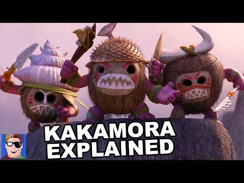
https://www.youtube.com/watch?v=LPNfVXOmQ0U
The Truth About Kakamora - YouTube
Today J dives into the world of Disney’s Moana and tries to uncover the truth about the unusual little coconut pirates known as Kakamora. Hey Super Carlin Fr...
Today J dives into the world of Disney’s Moana and tries to uncover the truth about the unusual little coconut pirates known as Kakamora. Hey Super Carlin Fr...
http://www.wyspy.webd.pl/en,kakamora.html
https://www.theodysseyonline.com/putting-the-myth-into-moana
Putting The Myth In 'Moana'
Explanation of Mythology in Moana with minor spoilers ...
Explanation of Mythology in Moana with minor spoilers ...
https://www.youtube.com/watch?v=MgqSCFpJgss
Tamatoa is REAL?!? - YouTube
Today we ask: Is Tamatoa real?! Ben dives into Disney's Moana to reveal the startling truth about the villainous 50-foot crab Tamatoa and if he actually exis...
Today we ask: Is Tamatoa real?! Ben dives into Disney's Moana to reveal the startling truth about the villainous 50-foot crab Tamatoa and if he actually exis...

※ 編輯: Ctea 時間: 2018-09-03 09:43:26, 09:53:08, 11:07:30, 11:14:53, 11:20:15, 11:31:16
> https://www.plurk.com/p/klsg69 傳說解密了:毛利人的家鄉,是來自於台灣!
> https://www.plurk.com/p/l9ee2s 台灣的先民絕非在六千年前從大陸遷移來的
> https://www.plurk.com/p/m2twwn 他們的祖先都來自台灣
> https://www.plurk.com/p/me7bw0 科學研究:毛利人是台灣人後裔
https://scitechvista.nat.gov.tw/c/s28P.htm
考古學研究的科學趣味:老鼠、麵包樹與豬–南島語族的遷徙-科技大觀園
![[圖]]() 最後一波大規模的移民 南島語族(Austronesian)是一群跨越東南亞和大洋洲的複雜民族群體,現代正說著或祖先曾使用過的語言有300到500種。他們的分布跨越全球57%的經度(206度),東自復活節島(Easter Island, 110° W),西到馬達加斯加島(Madagascar, 44° E ...
最後一波大規模的移民 南島語族(Austronesian)是一群跨越東南亞和大洋洲的複雜民族群體,現代正說著或祖先曾使用過的語言有300到500種。他們的分布跨越全球57%的經度(206度),東自復活節島(Easter Island, 110° W),西到馬達加斯加島(Madagascar, 44° E ...
![[圖]](https://scitechvista.nat.gov.tw/context/image/jpg/96f6b821d8532f9f3053ba9ab0de86e3b7e8655d74f21230ba6f151940c49a77_540_380.htm)
https://pansci.asia/archives/107324
航向太平洋的DNA之旅:南島語族與拉匹達關係解密 - PanSci 泛科學
![[圖]]()
![[圖]]()
![[圖]]() 當歐洲人抵達由大大小小島嶼,以及浩瀚無界汪洋組成的大洋洲時,除了澳洲與部分的新幾內亞之外,幾乎整個太平洋都是南島語族(Austronesian-speaking peoples)的天下。 ...
當歐洲人抵達由大大小小島嶼,以及浩瀚無界汪洋組成的大洋洲時,除了澳洲與部分的新幾內亞之外,幾乎整個太平洋都是南島語族(Austronesian-speaking peoples)的天下。 ...
![[圖]](http://i4.disp.cc/t/s2/pansci.asia/39a086e948956b424cdf3a7bd8e6add9.png)
![[圖]](http://i4.disp.cc/t/s2/pansci.asia/45cff51518a021f38431ee82f5bcd6fd.png)
![[圖]](http://i4.disp.cc/t/s2/pansci.asia/ee309c9005e642244aae0d4ec5691530.png)
#南島語系 #出台灣說
※ 編輯: Ctea 時間: 2018-09-03 11:38:18
https://www.plurk.com/p/necvsq
成功重現3萬年前航海 獨木舟台灣出發45小時後抵達與那國島
#南島 #琉球
※ 編輯: Ctea 時間: 2019-07-10 00:36:57
https://www.google.com/search?q="Mau...p;sourceid=chrome&ie=UTF-8
"Maui" "Mawi" "Truku" - Google Search
https://www.google.com/search?q="Mau...p;sourceid=chrome&ie=UTF-8
"Maui" "Mawi" "Taroko" - Google Search
https://www.plurk.com/p/nx4i4f
※ 編輯: Ctea 時間: 2020-07-17 16:12:30 (台灣)
[筆記] note Google Search: 地質 板塊陸塊 海洋大陸 火山 礦物 地球科學 環境地形 南島語系
https://en.wikipedia.org/wiki/Māui_(mythology) #Trickster
https://zh.wikipedia.org/zh-tw/馬威_(巨人)
#惡作劇 #巨人 #馬威 #太魯閣族 #台灣原住民
※ 編輯: Ctea 時間: 2020-07-16 03:21:10, 03:22:13 (台灣)
> https://en.wikipedia.org/wiki/Mu_(mythical_lost_continent)
https://en.wikipedia.org/wiki/Maui_Nui
Maui Nui
#夏威夷
※ 編輯: Ctea 時間: 2021-09-10 01:50:44 (台灣)
> https://disp.cc/b/261-cNgR #番薯
#地瓜
https://en.wikipedia.org/wiki/Mu_(mythical_lost_continent)
After the Pleistocene, cultures of the Americas and the Old World developed social complexity independent of each other, and, in fact, agriculture and sedentism emerged in multiple locations around the world after the inception of the Holocene at 11,700 BP. The emergence of Pre-Pottery Neolithic A sites such as Göbekli Tepe and Neolithic villages such as Jericho and Çatalhöyük in the Levant and Anatolia, respectively, result from local processes of cultural evolution, not colonization by individuals from elsewhere.
https://en.wikipedia.org/wiki/Sweet_potato
https://en.wikipedia.org/wiki/Sweet_potato_cultivation_in_Polynesia
Sweet potato cultivation in Polynesia
#番薯 #文化進化 #農業革命 #殖民
※ 編輯: Ctea 時間: 2021-09-10 01:52:41, 01:53:51 (台灣)
> 14 #抖音北七
檔案? via FTB]
- Lemuria狐猴大陸明明就是在印度次大陸底下的假說大陸。
夏威夷那個是穆大陸,但實際上提出穆大陸假說的人根本不理解大陸飄移與大洋洲大陸之概念與南島民族的航海能力。
- 穆大陸要是真的存在,連台灣都算在內了
※ 編輯: Ctea 時間: 2022-05-10 15:20:58 (台灣)
[= #大洋洲 #海洋大陸 #海之大陸 #南島民族 #南島語族 #失落大陸
> -------------------------------------------------------------------------- <
https://en.wikipedia.org/wiki/List_of_lost_lands
List of lost lands
https://en.wikipedia.org/wiki/Submerged_continent #淹沒 #海沒大陸
Submerged continent
※ 編輯: Ctea 時間: 2020-03-13 04:18:37 (台灣)
https://en.wikipedia.org/wiki/Lost_City_Hydrothermal_Field
Lost City Hydrothermal Field 大西洋底的失落之城
via https://en.wikipedia.org/wiki/Atlantis_Massif
Atlantis Massif 大西洋地塊
※ 編輯: Ctea 時間: 2020-05-08 05:43:56, 05:44:59 (台灣)
https://en.wikipedia.org/wiki/Anticline
背斜構造
https://en.wikipedia.org/wiki/Weald–Artois_Anticline
Weald–Artois Anticline
via https://en.wikipedia.org/wiki/Prehistoric_Britain #史前英國
#英吉利海峽 #阿爾卑斯山造山運動 #北海南邊 #英國 #法國 #多佛海峽Dover #克爾特區
※ 編輯: Ctea 時間: 2020-05-15 03:40:38 (台灣)
https://en.wikipedia.org/wiki/Eocene
Eocene 始新世
https://commons.wikimedia.org/wiki/File:Eocene_Europe_amber_map.jpg
歐洲
via https://en.wikipedia.org/wiki/Baltic_amber
波羅地海琥珀 Baltic amber
via https://commons.wikimedia.org/wiki/F...a,_Dictyoptera,_Blattodea).JPG
※ 編輯: Ctea 時間: 2020-07-01 15:32:29, 15:33:11 (台灣)
https://en.wikipedia.org/wiki/Deccan_Traps via https://en.wikipedia.org/w/index.php?title=Dinosaur&oldid=967106132 #恐龍
Deccan Traps #印度 #瑞典文台階
德干暗色岩(Deccan Traps,又譯德干玄武岩),是一個大火成岩省,位於印度南部的德干高原,是地表上最大型的火山地形之一。德干玄武岩由多層洪流玄武岩所構成,厚度超過2,000公尺,面積為50萬平方里。
※ 編輯: Ctea 時間: 2020-07-27 16:13:06 (台灣)
https://commons.wikimedia.org/wiki/File:World_geologic_provinces.jpg
世界各地的地質結構(成因來分)
via https://zh.wikipedia.org/zh-tw/大型火成岩区域
https://commons.wikimedia.org/wiki/File:Flood_Basalt_Map.jpg
via https://en.wikipedia.org/wiki/Large_igneous_province
大型火成岩區 / 大火成岩省
#火山
※ 編輯: Ctea 時間: 2020-07-27 16:16:04 (台灣)
https://en.wikipedia.org/wiki/Atoll
via https://en.wikipedia.org/wiki/Line_Islands
via https://www.instagram.com/p/CDu4H0blKsS/ #Southern Line Islands #太平洋
#Lagoon #Atoll #封閉式潟湖 #環礁 #珊瑚礁
※ 編輯: Ctea 時間: 2020-08-13 03:01:40 (台灣)
> https://www.plurk.com/p/ncg2pw
> https://www.plurk.com/p/nv441o
https://tw.news.yahoo.com/牛奶海-秘境夯-藍白海水交織成打卡熱點-060005951.html
「牛奶海」秘境夯!藍白海水交織成打卡熱點 [影片] - Yahoo奇摩新聞
#火山 #海底溫泉 #龜山島 #晴空蘇打
via FTB
※ 編輯: Ctea 時間: 2020-09-07 05:17:53 (台灣)
https://en.wikipedia.org/wiki/Archipelago
Archipelago
#群島 #島群 #島鏈 #列島
※ 編輯: Ctea 時間: 2020-10-01 13:43:43 (台灣)
https://en.wikipedia.org/wiki/Sunda
https://en.wikipedia.org/wiki/Sundaland
https://commons.wikimedia.org/wiki/File:Map_of_Sunda_and_Sahul.png
#Sunda #生態系
https://en.wikipedia.org/wiki/Sahul
https://en.wikipedia.org/wiki/Australia_(continent)
https://en.wikipedia.org/wiki/Sahul_Shelf
#Sahul #澳洲大陸
https://zh.wikipedia.org/zh-tw/大陆岛
大陸島指的是其地質構造與鄰近的大陸相似,原屬大陸的一部分,由於地殼下沉或海水上升以至於其與大陸相隔成島。按其形成的原因可分為構造島(又可分成板塊及非板塊交界帶兩類)和沖蝕島兩種。
※ 編輯: Ctea 時間: 2021-04-10 07:44:31 (台灣)
https://en.wikipedia.org/wiki/Maritime_Southeast_Asia
海洋東南亞 #南洋群島
via https://en.wikipedia.org/wiki/Borneo
#Borneo #婆羅洲
※ 編輯: Ctea 時間: 2021-04-10 07:45:05 (台灣)
> https://en.wikipedia.org/wiki/Antarctica
https://en.wikipedia.org/wiki/Polar_desert
Polar desert
#極地沙漠
https://en.wikipedia.org/wiki/Meyer_Desert_Formation_biota
Meyer Desert Formation biota
#南極 #沙漠
Screenshot (99)
https://www.google.com/search?q=fore...p;sourceid=chrome&ie=UTF-8
https://en.wikipedia.org/wiki/Sahara
During the Last Glacial Maximum (LGM) the Sahara desert was more extensive than it is now with the extent of the tropical forests being greatly reduced, and the lower temperatures reduced the strength of the Hadley Cell.
https://en.wikipedia.org/wiki/North_Saharan_steppe_and_woodlands
The North Saharan steppe and woodlands is a desert ecoregion, in the Deserts and xeric shrublands biome, that forms the northern edge of the Sahara.
https://en.wikipedia.org/wiki/Petrified_Forest_National_Park
Petrified Forest National Park is an American national park in Navajo and Apache counties in northeastern Arizona.
#木化石森林國家公園
※ 編輯: Ctea 時間: 2021-05-28 16:48:52 (台灣)
https://www.dailystar.co.uk/news/weird-news/libyan-desert-glass-atomic-war-16868051
MAPPED: Incredible evidence of ‘ATOMIC WARS’ fought THOUSANDS of years ago - Daily Star
https://www.bing.com/images/search?q...irst=1&tsc=ImageBasicHover
Libyan Desert glass - Bing images
#沙漠玻璃 #大戈壁 #力比亞玻璃 #不是原子彈
※ 編輯: Ctea 時間: 2021-06-04 15:08:53 (台灣)
https://en.wikipedia.org/wiki/Kerguelen_Plateau
Kerguelen Plateau
#海台
※ 編輯: Ctea 時間: 2021-09-10 01:37:22, 01:46:38 (台灣)
https://en.wikipedia.org/wiki/Laurentia
Laurentia or the North American Craton is a large continental craton that forms the ancient geological core of North America. Many times in its past, Laurentia has been a separate continent, as it is now in the form of North America, although originally it also included the cratonic areas of Greenland and also the northwestern part of Scotland, known as the Hebridean Terrane. During other times in its past, Laurentia has been part of larger continents and supercontinents and itself consists of many smaller terranes assembled on a network of Early Proterozoic orogenic belts. Small microcontinents and oceanic islands collided with and sutured onto the ever-growing Laurentia, and together formed the stable Precambrian craton seen today.
#北美地塊 #陸塊 #綠島 #格林蘭 #格陵蘭 #蘇格蘭
※ 編輯: Ctea 時間: 2021-10-25 04:57:53, 04:59:01 (台灣)
https://en.wikipedia.org/wiki/Terrane
Terrane
在地質學上,地體是地殼物質的碎塊,它或者在一個板塊上形成,或者從一個板塊上斷裂而成,後來增生(或者叫「縫合」)到另一個板塊之上。這時,這一地殼塊或碎片仍保有它自己獨特的地史,而和周邊區域不同(因此,偶然也用外來地體這一術語)。地體和它所附著的地殼之間的縫合線通常是一個斷層。
#日記My Notepad, [08/01/2022 19:24]
https://en.wikipedia.org/wiki/Craton
Craton
克拉通(來自希臘語kratos,意為「強度」),或稱穩定地塊、大陸核心、古陸、古陸核、剛塊、安定地塊,是指大陸地殼上的古老而穩定的部分,於最近至少5億年內的大陸和超大陸的會聚和分裂過程中幾乎沒有發生變化。有些克拉通甚至在20億年前或更早就形成了。克拉通一般都存在於大陸內部,由古代的結晶基底構成,這些基岩的成分主要是小比重的長英質火成岩如花崗岩。克拉通內的地殼較厚,並有深根插入地函,可達200公里深處。
#日記My Notepad, [08/01/2022 19:25]
https://en.wikipedia.org/wiki/Cimmeria_(continent)
Cimmeria (continent)
辛梅利亞大陸(英語:Cimmeria)是個小型史前大陸,位於辛梅利亞板塊,包含現今的土耳其、伊朗、阿富汗、西藏、中南半島、馬來亞等陸塊。
在晚石炭紀時期,辛梅利亞大陸自盤古大陸分裂出來,並往北移動。在晚三疊紀,辛梅利亞大陸開始與華南陸塊碰撞。在侏儸紀,辛梅利亞大陸成為勞亞大陸的一部分,並形成辛梅利亞造山運動。而辛梅利亞板塊已經侵入到勞亞大陸之下。辛梅利亞自東向西從岡瓦納大陸分裂出來,從澳大利亞到東地中海。
#日記My Notepad, [08/01/2022 19:27]
※ 編輯: Ctea 時間: 2022-01-10 03:00:36 (台灣)
https://en.wikipedia.org/wiki/Sargasso_Sea
The Sargasso Sea (/sɑːrˈɡæsoʊ/) is a region of the Atlantic Ocean bounded by four currents forming an ocean gyre.
Unlike all other regions called seas, it has no land boundaries.
It is distinguished from other parts of the Atlantic Ocean by its characteristic brown Sargassum seaweed and often calm blue water.[
#中南美洲外海 #西大西洋 #大西洋西側
※ 編輯: Ctea 時間: 2022-02-21 13:06:10 (台灣)
※ 編輯: Ctea 時間: 2022-05-23 17:03:00 (台灣)
#日記My Notepad, [13/06/2022 04:28]
https://en.wikipedia.org/wiki/Décollement
Décollement 滑脫面
via https://en.wikipedia.org/wiki/Chthon#Other_uses
Chthon
Allochthon, structural geology: from the Greek "allo", meaning other, and "chthon". Process of the land mass being moved under the earth and connecting two horizontally stacked décollements and thus "under the earth"
#地層
※ 編輯: Ctea 時間: 2022-06-13 04:28:59 (台灣)
※ 編輯: Ctea 時間: 2022-09-13 08:27:49 (台灣)
https://twitter.com/CONTEMPRA_INN/status/1562632744886497280
[ContempraINN🌹] AWESOME 🤙 ADVENTURE along the Na Pali Coast on the island of Kauai, Hawaii, 💙Waiahuaka Cave This remote cave, stretching over 350 meters is the second longest sea cave in the world #Adrenaline #Travel #Wanderlust
@isinebakabisi
@CONTEMPRA_INN🌹
https://twitter.com/tyomateee/status/1538824424086183936
【最多情報局】世界で2番目に長いハワイ島の海蝕洞窟、アトラクションのようでスリル満点過ぎる…
#地形 #夏威夷 #海蝕地形洞穴 #很像遊樂園會有的設施
via https://www.plurk.com/p/ow8tf7
好像很有趣
![[圖]](https://emos.plurk.com/5846529abb90cabba6ce1c7560942ca9_w48_h38.gif)
不過我大概上船5分鐘就落海了 [img][https://emos.plurk.com/5846529abb90cabba6ce1c7560942ca9_w48_h38.gif/img]
& https://twitter.com/xr888_k7/status/1580765251573645312
位於夏威夷的超長海蝕洞穴,好像遊樂園的設施,好想去!!!
& https://twitter.com/CteaX55/status/1580766899486744576
置夏ôa夷上長ê海蝕空,宛若遊樂園ê attraction!!
#夏威夷
#海蝕地形
#台語漢字
※ 編輯: Ctea 時間: 2022-10-14 11:39:05, 11:39:59, 11:46:45 (台灣)
※ 編輯: Ctea 時間: 2022-10-16 13:25:42 (台灣)
https://en.wikipedia.org/wiki/Porphyry_(geology)#Modern_uses
#火成岩 #冬季輪胎使用之道路 #柏油路 #混入
#火山
※ 編輯: Ctea 時間: 2022-10-16 14:59:25 (台灣)
※ 編輯: Ctea 時間: 2022-10-20 17:32:00, 17:33:30, 17:34:11 (台灣)
https://twitter.com/jamafra1243/status/1600824705308626944
【世界の動物図鑑@スマホケース販売中】ベナジル洞窟
ポルトガルのベナジルにある海に侵食された洞窟をドローンで上空から。
海が侵食したのか?洞窟が海を侵食しているのか?
#Drone無人機空拍 #葡萄牙 #貝納吉爾海蝕洞
p37c4v
※ 編輯: Ctea 時間: 2022-12-09 02:44:59 (台灣)
※ 編輯: Ctea 時間: 2022-12-11 04:53:31, 04:53:40 (台灣)
https://twitter.com/i/status/1601386550033383426
[OddIy Terrifying] Boat collides with massive wave in the deep sea🌊
via https://twitter.com/tyomateee/status/1601932463974277120
【最多情報局】船に巨大な波が衝突する瞬間、海の恐ろしさが分かる…
#驚滔駭浪 #海浪衝擊 #海洋的恐怖 #船隻 #船頭 #船首 #錄影
p3czej
※ 編輯: Ctea 時間: 2022-12-13 01:15:59 (台灣)
※ 編輯: Ctea 時間: 2022-12-15 14:12:16 (台灣)
※ 編輯: Ctea 時間: 2023-01-10 18:32:48 (台灣)
https://en.wikipedia.org/wiki/Mesopelagic_zone
The mesopelagic zone (Greek μέσον, middle), also known as the middle pelagic or twilight zone, is the part of the pelagic zone that lies between the photic epipelagic and the aphotic bathypelagic zones.
via https://en.wikipedia.org/wiki/Helicocranchia_pfefferi
from: https://disp.cc/b/261-d0xy
※ 編輯: Ctea 時間: 2023-02-01 15:26:12, 15:26:27 (台灣)
https://en.wikipedia.org/wiki/Socotra
Socortra
https://en.wikipedia.org/wiki/Soqotri_language
Soqotri language
https://youtube.com/shorts/Jv_oWG4U1Hg?si=EnSIkaIECMiOmarE
The Weirdest Island on Earth!#avatar #avatarthewayofwater

Denise Gui, [13/03/2023 20:45] #日記
※ 編輯: Ctea 時間: 2023-03-13 22:57:31, 22:58:38 (台灣)
https://youtube.com/watch?v=VN5EoMGb-xw&si=EnSIkaIECMiOmarE
The Alien Beauty of Socotra Island
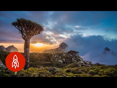
#有如外星景象
Denise Gui, [18/03/2023 16:49]
※ 編輯: Ctea 時間: 2023-03-19 03:09:05 (台灣)
※ 編輯: Ctea 時間: 2023-04-11 02:28:10 (台灣)
#通同字
> https://www.plurk.com/p/p9x2ga
My Notepad, [04/06/2023 12:18]
https://www.google.com/search?q=地質...eid=chrome-mobile&ie=UTF-8
地質 摺ㄓㄡˋ - Google Search
https://www.cyut.edu.tw/~jrlai/CE8331/EG04.pdf
CH4 地質構造及地質圖
https://lms.nchu.edu.tw/sysdata/doc/2/2157305b22b72d88/pdf.pdf
工程地質
https://www.ceci.org.tw/Upload/Download/7BD42ABA-8E02-4279-A3BE-8595A1D0A467.pdf
蘇花改觀音隧道數種常見形成岩體弱帶之地質構造
https://www.spnp.gov.tw/cp.aspx?n=14553
雪霸國家公園全球資訊網-地質資源
#褶皺
※ 編輯: Ctea 時間: 2023-06-05 00:24:22 (台灣)
> https://www.plurk.com/p/pewh8r #隱沒帶
https://en.wikipedia.org/wiki/List_of_hot_springs
List of hot springs
#溫泉
#火山
※ 編輯: Ctea 時間: 2023-10-11 02:18:37 (台灣)
https://en.wikipedia.org/wiki/Template:Tectonic_plates
https://en.wikipedia.org/wiki/Template:Geology_of_Europe
https://en.wikipedia.org/wiki/Geirangerfjord
Geirangerfjord
#挪威Norway #歐洲板塊
※ 編輯: Ctea 時間: 2023-11-01 14:30:59 (台灣)
https://en.wikipedia.org/wiki/Amurian_Plate
Amurian Plate
黑龍江板塊
#滿州/中國東北
#韓國/朝鮮半島
#日本海、四國、九州、關西、中國
#蒙古東部
#俄國遠東部
※ 編輯: Ctea 時間: 2023-11-02 12:52:14 (台灣)
https://www.youtube.com/watch?v=eaF3hB5rYZQ
Lemuria: History of the Enigmatic World of Ancient Civilization

by STORIES NETWORK https://www.youtube.com/@SD-NETWORK
#狐猴大陸 #不是歷史頻道 #節目上傳
※ 編輯: Ctea 時間: 2023-12-23 11:15:29 (台灣)
> https://www.plurk.com/p/phw40m?r=8000142061
https://www.google.com/search?q=icel...p;sourceid=chrome&ie=UTF-8
#冰島有鑽石 via Denise*
※ 編輯: Ctea 時間: 2024-01-15 16:25:04 (台灣)
: ↓ Massively moved from https://disp.cc/b/261-9rHB by 202402020951
: Moved from: https://disp.cc/b/261-9fJ7
https://www.cna.com.tw/news/aopl/201801170268.aspx
世界最大水底洞穴 墨西哥現蹤
https://www.cna.com.tw/news/acul/201912200223.aspx
和平島考古 西班牙修道院遺跡再挖到遺骸
via https://bit.ly/2ZKUk1w
#澎湖 #台灣海域 #拉丁美洲 #中南美洲
※ 編輯: Ctea 時間: 2020-01-01 17:13:19 (台灣)
※ 編輯: Ctea 時間: 2020-11-06 04:28:56 (台灣)
※ 編輯: Ctea 時間: 2021-01-12 05:49:26, 05:49:36 (台灣)
https://en.wikipedia.org/wiki/Lost_City_of_the_Kalahari
Lost City of the Kalahari
#南非 #沙漠 #失落的城市 #考古 #探險
※ 編輯: Ctea 時間: 2021-10-18 03:37:07 (台灣)
: ↑ Massively moved from https://disp.cc/b/261-9rHB by 202402020951
※ 編輯: Ctea 時間: 2024-02-02 09:53:13 (台灣)
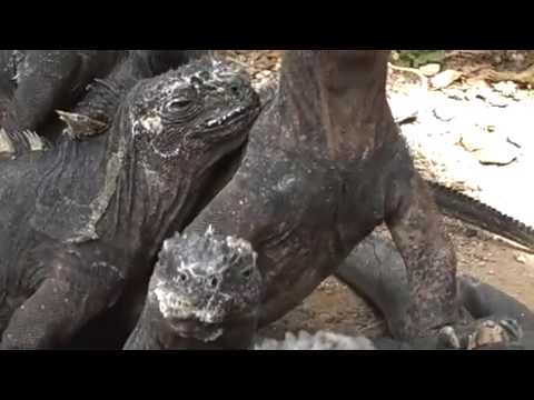
https://visibleearth.nasa.gov/images/152538/an-eruption-for-galapagos-iguanas/152538f
An Eruption for Galápagos Iguanas
2024-3-09 07:00:57
via https://www.plurk.com/p/3fjtfcp6xl
in An Eruption for Galápagos Iguanas
https://eoimages.gsfc.nasa.gov/images/imagerecords/152000/152538/fernandinavolcano_vir_20240305.jpg
https://imgs.plurk.com/QEz/g9I/Gk3VBLmTsaOYKo9JOBY8zZ2TXi7_lg.jpg
https://eoimages.gsfc.nasa.gov/images/imagerecords/152000/152538/fernandinavolcano_oli_20240307.jpg
https://imgs.plurk.com/QEz/kY9/z9xzbHJujcJdE7pvBSwdrfogLAe_lg.jpg
https://www.youtube.com/watch?v=sXGueUxOLKw
Marine Iguanas of the Galapagos
by NASAEarthObservatory https://www.youtube.com/@NASAEarthObservatory
#火山爆發 #加拉巴戈斯群島 #海蜥蜴
※ 編輯: Ctea 時間: 2024-03-09 18:59:53 (台灣)
※ 編輯: Ctea 時間: 2024-03-10 00:21:59 (台灣)
https://en.wikipedia.org/wiki/Thule
Thule Θούλη
#希臘探險家 #北極海 #古典時期 #古典時代 #圖勒
※ 編輯: Ctea 時間: 2017-02-06 17:31:12, 17:36:21, 17:42:23, 17:42:39, 17:43:16
https://disp.cc/b/261-f0QA#:~:text=Thule
※ 編輯: Ctea 時間: 2022-06-06 17:55:25 (台灣) * Added by 202403212101
https://images.plurk.com/1x3qshuHESVfUbjSU6Cbtp.jpg
![[圖]](https://images.plurk.com/1x3qshuHESVfUbjSU6Cbtp.jpg)
https://www.google.com/maps/search/Thule/@76.4449922,-73.4896036,5.75z?entry=ttu
4825347 #圖咧 #圖哩 #圖呢 #圖勒 27 October 2021, 08:11:30
= 分隔線 =
https://en.wikipedia.org/wiki/Qaanaaq
= 分隔線 =
Qaanaaq (Greenlandic pronunciation: [qaːnɑːq]), formerly known as Thule or New Thule, is the main town in the northern part of the Avannaata municipality in northwestern Greenland. It is one of the northernmost towns in the world. The inhabitants of Qaanaaq speak the local Inuktun language and many also speak Kalaallisut and Danish. The town has a population of 646 as of 2020.[1] The population was forcibly relocated from its former, traditional home, which was expropriated for the construction of a United States Air Force base in 1953.
= 分隔線 =
> http://www.plurk.com/p/lv4ebh 格陵蘭冰冠溶解 揭美軍冷戰機密:「冰蟲作戰」一環的世紀營所埋藏的核廢料
https://www.google.com/maps/place/Pi...1465!16zL20vMDM4Nmgx?entry=ttu
Pituffik Space Base - Google Maps
https://en.wikipedia.org/wiki/Pituffik_Space_Base
#美軍基地 #北歐綠島
https://en.wikipedia.org/wiki/CFS_Alert
Canadian Forces Station Alert (French: Station des Forces canadiennes Alert), often shortened to CFS Alert (SFC Alert), is a signals intelligence intercept facility of the Canadian Armed Forces at Alert, in the Qikiqtaaluk Region of Nunavut, Canada.
※ 編輯: Ctea 時間: 2024-03-21 21:11:32, 21:12:51 (台灣)
https://www.google.com/search?q=coll...AHoSU&sclient=gws-wiz-serp
collapsed dome volcano - Google Search
https://www.nps.gov/articles/000/dom...side or become over-steepened.
Volcanic Domes (U.S. National Park Service)
https://www.nps.gov/articles/000/ima...amp;quality=78&format=webp
Cerro La Jara, a rhyolite dome that formed in the in Valles Caldera National Preserve about 540,000 years ago.
https://www.google.com/maps/search/c...18392m/data=!3m1!1e3?entry=ttu
https://www.nps.gov/articles/000/domes.htm#nps-domes
Volcanic Domes (U.S. National Park Service)
#火山椎
※ 編輯: Ctea 時間: 2024-03-25 19:51:26 (台灣)
https://en.wikipedia.org/wiki/Beringia
#白令海峽 #沉沒古陸
※ 編輯: Ctea 時間: 2024-03-25 20:05:41, 20:07:54, 20:08:22 (台灣)
※ 編輯: Ctea 時間: 2024-03-26 22:34:02 (台灣)
https://open.spotify.com/episode/06VI48dhKCVSW7giEj3Ye0?si=cUhBalIKTbaT3Ag7enZCug
She Sails the Seas Without Maps or Compasses
#國家地理Podcast #夏威夷 #航海大陸 #導航 #泛舟橫跨大陸
※ 編輯: Ctea 時間: 2024-04-03 16:21:04 (台灣)
https://en.wikipedia.org/wiki/Subduction_zone_metamorphism
Subduction zone metamorphism
#隱沒帶變質岩
※ 編輯: Ctea 時間: 2024-04-25 04:56:49 (台灣)
https://www.youtube.com/watch?v=RgVAbsKItho
地震竟有分速? 台灣"慢地震"罕見落在中央山脈 隱身雜訊震動波不明顯 一躍恐加速大地震觸發|非凡財經新聞|20240822
大地震後常見
非隱沒帶
南海海槽 日本
#日記202409062222
https://cdn-news.org/news/N2408260008
罕見「慢地震」 慢地震與大地震有關係嗎?一起來認識與警醒 | 基督教今日報
赴日旅遊要當心! 千葉外海地震頻頻專家:這是「慢地震」|TVBS ...
https://innews.pts.org.tw/video/MTk5Ng
慢快地震之謎| 獨立特派員
https://www.youtube.com/watch?v=byIcAu_XcN8
台日學者交流,共同研究慢、快地震|慢快地震之謎|公視#獨立 ...
https://www.youtube.com/watch?v=zsdA0S_JjZw
【日本宮崎強震】雄中日本交流遇7.1強震! 「海嘯注意警報」區域 ...
https://www.youtube.com/watch?v=8y0jPE1s7wA
地震分快慢!「慢地震」隱身雜訊震動波不明顯
※ 編輯: Ctea 時間: 2024-09-06 22:13:54, 22:23:31, 22:24:57 (台灣)
https://www.youtube.com/watch?v=_LJG68AmZxI
1.8 Billion Years of Plate Tectonics

by https://www.youtube.com/@TectonicsandEarthSystemsGroup
via https://theconversation.com/witness-...face-in-a-new-animation-238209
Witness 1.8 billion years of tectonic plates dance across Earth’s surface in a new animation
Using information from inside the rocks on Earth’s surface, we have reconstructed the plate tectonics of the planet over the last 1.8 billion years.
It is the first time Earth’s geological record has been used like this, looking so far back in time. This has enabled us to make an attempt at mapping the planet over the last 40% of its history, which you can see in the animation below.
The work, led by Xianzhi Cao from the Ocean University in China, is now published in the open-access journal Geoscience Frontiers.
https://www.sciencedirect.com/science/article/pii/S1674987124001464
Earth’s tectonic and plate boundary evolution over 1.8 billion years - ScienceDirect
[更新]
https://www.plurk.com/p/3g9mmeb8hb
新的時光逆轉動畫呈現了18億年來的地殼板塊運動之變遷
不知道之後會不會出個順時的
#地殼變動 #板塊運動 #動畫
※ 編輯: Ctea 時間: 2024-09-07 20:26:06 (台灣)
※ 編輯: Ctea 時間: 2024-09-08 00:45:11 (台灣)
※ 編輯: Ctea 時間: 2024-09-08 04:25:58, 04:28:57, 04:30:06 (台灣)
* Updated by 202502020258
一百萬年後的非洲大陸:東非大裂谷將形成第六大洋
https://www.thebrighterside.news/upl...&quality=70&width=1920
https://www.thebrighterside.news/post/scientists-discover-the-formation-of-earths-sixth-ocean/
Scientists discover the formation of Earth’s sixth ocean
Far from being a mere curiosity, the East African rift could drastically alter the geography of our planet and become the Earth’s sixth ocean
https://www.thebrighterside.news/space/giant-gravity-hole-discovered-in-the-indian-ocean/
Giant “Gravity Hole” discovered in the Indian Ocean
https://www.sciencedirect.com/science/article/abs/pii/S0012821X04001232?via=ihub
Angular velocities of Nubia and Somalia from continuous GPS data: implications on present-day relative kinematics
#東非大裂谷 #第六洋 #五大洋 #衣索比亞 #地殼變動
* The Atlantic Ocean is getting wider every year, study finds
https://www.thebrighterside.news/post/the-atlantic-ocean-is-getting-wider-every-year-study-finds
* Massive underground ocean discovered containing 3x more water than the oceans combined
https://www.thebrighterside.news/pos...water-than-the-oceans-combined
* ‘The Last of Us’ for amphibians: Scientists trace emergence of fungus threatening Africa
https://www.thebrighterside.news/pos...e-of-fungus-threatening-africa
#大西洋 #越來越寬 就跟台灣一年比一年高一樣 #地質上的時間維度 #威脅非洲的蕈類 #香菇 #板塊張裂帶 #印度洋重力場 #日記202502021448
※ 編輯: Ctea 時間: 2025-02-01 22:00:02 (台灣)
※ 編輯: Ctea 時間: 2025-02-02 02:58:42 (台灣)
※ 編輯: Ctea 時間: 2025-02-02 14:49:04 (台灣)
【筆記】移除標題「礦物」標籤。
※ 編輯: Ctea 時間: 2025-02-23 05:27:40 (台灣)
https://www.popularmechanics.com/sci...outheast-asia/?search.app/KeBM
Archaeologists Found Ancient Tools That Contradict the Timeline of Civilization
Sophisticated seafaring technology may actually have originated in the islands of Southeast Asia
#東南亞 #複雜航海技術 #南島民族 #海之大陸 #海洋大陸
#考古新發現 #黑科技 #科技發展時間線 #矛盾 #古代人的智慧 #文明發展史
※ 編輯: Ctea 時間: 2025-03-01 12:59:27 (台灣)
※ 編輯: Ctea 時間: 2025-03-01 15:03:46 (台灣)
https://maps.app.goo.gl/J9eoMK5ahFn4Zc818
頭目山拍攝地點
#地質奇景 #大自然鬼斧神工 #地形 #人臉側面
#台東成功鎮
#頭目山
via https://disp.cc/b/261-gOfi#:~:text=_4625944
#Sigma
※ 編輯: Ctea 時間: 2025-03-19 23:30:35 (台灣)
※ 編輯: Ctea 時間: 2025-03-20 01:08:35 (台灣)
※ 編輯: Ctea 時間: 2025-03-20 01:08:59 (台灣)
https://en.wiktionary.org/wiki/fen
https://en.wiktionary.org/w/index.php?title=fen&oldid=84537829
https://commons.wikimedia.org/wiki/File:Illustrated_diagram_of_a_fen.jpg
#沼澤 via Fenrir
※ 編輯: Ctea 時間: 2025-04-14 23:11:54 (台灣)
※ 編輯: Ctea 時間: 2025-05-05 05:34:22 (台灣)
https://en.wikipedia.org/wiki/Mauna_Kea
via https://en.wiktionary.org/wiki/Mauna_Kea
A dormant volcano in Hawaii; the tallest mountain in the world from its base on the sea floor.
from https://www.plurk.com/p/3i89lst1ku?r=637592662570318
啊突然想到夏威夷的Mt. Mauna Kea跟Mt. Mauna Loa也是贅字,Mauna在夏威夷語裡面是「白色之山」的意思
- 一個白山一個長山,原來夏威夷文也是「名詞+形容詞」(雖然不少這樣類型的,但自己目前接觸過的就是拉丁文、法文、越南文,現在多了夏威夷文)
夏威夷 火山 白山 海床
※ 編輯: Ctea 時間: 2026-01-22 23:52:02 (台灣)
https://en.wikipedia.org/wiki/Sundaland
Sundaland
https://en.wikipedia.org/wiki/Sunda_Shelf
Sunda Shelf
https://commons.wikimedia.org/wiki/File:SEA_submerged_River_Systems.svg
via https://en.wikipedia.org/w/index.php?title=Sunda_Shelf&oldid=1343446190#Submerged_river_systems
地下河系統 / 伏流河
https://en.wikipedia.org/wiki/Malay_Peninsula
Malay Peninsula
馬來半島
https://en.wikipedia.org/wiki/Peninsular_Malaysia
Peninsular Malaysia
馬來西亞半島(半島馬來西亞 / 馬來西亞的中南半島部分)
- 原來馬來半島橫跨三個國家@@
緬甸最南端、泰國南部、馬來西亞半島
# 中南亞 # 中南半島的一部分
※ 編輯: Ctea 時間: 2026-03-24 21:42:12 (台灣)
※ 編輯: Ctea 時間: 2026-03-25 01:08:08 (台灣)
※ 編輯: Ctea 時間: 2026-03-25 01:09:17 (台灣)
※ 編輯: Ctea 時間: 2026-03-25 01:10:56 (台灣)
※ 同主題文章:
03-15 21:20 □ [筆記] 689真的不是真的「有病」就能一言以蓋的
… ×223
12-25 18:09 Re [筆記] note Google Search: 環境議題
12-25 18:09 □ [筆記] note Google Search: 手工皂 #肥皂 #香皂
12-25 18:09 □ [筆記] note Google Search: 國泰航空鹽巴胡椒罐
12-25 18:10 Re [筆記] note =
● 12-31 09:22 □ [筆記] note 地質 板塊陸塊 海洋大陸 火山 地球科學 環境地形 南島語系 考古
12-31 09:23 Re [筆記] note =
12-31 09:23 □ [筆記] 迎接新年音樂篇 by 台北愛樂:早安,愛樂! + 午安‧愛樂 + 音樂逍遙遊
01-04 11:28 □ [筆記] 新年音樂篇 by 台北愛樂: 早安,愛樂! + 午安‧愛樂
… ×2220
※ 看板: CityNight 文章推薦值: 0 目前人氣: 0 累積人氣: 291
回列表(←)
分享