看板 CityNight
作者 標題 Re: [筆記] note Google Search: 地質 礦物 地球科學 環境 地形 氣象
時間 2016-02-26 Fri. 18:09:33
#地球撞擊資料庫Earth Impact Database
https://en.wikipedia.org/wiki/Category:Earth_Impact_Database
https://en.wikipedia.org/wiki/Silverpit_crater
銀坑隕石坑 @英國外海
https://en.wikipedia.org/wiki/Chesapeake_Bay_impact_crater
切薩皮克灣隕石坑
隕石坑 @美國東部
https://en.wikipedia.org/wiki/Pneumatolysis
pneumatolysis
http://terms.naer.edu.tw/detail/363347/?index=5
氣成作用;氣化作用
#隕石撞擊
--
※ 作者: Ctea 時間: 2016-02-26 18:09:33
※ 編輯: Ctea 時間: 2016-03-18 15:25:53
https://www.google.com.tw/search?q=...eid=chrome-mobile&ie=UTF-8
http://kn22.ukn.edu.tw/files/13-1031-10232.php?Lang=zh-tw
http://sa.ylib.com/MagArticle.aspx?Unit=featurearticles&id=1215
台灣也曾有冰河 - 科學人雜誌
http://www2.nsysu.edu.tw/Mountain/trick/cirque.htm
台灣高山圈谷的地形作用環境
http://old.ltn.com.tw/2001/new/apl/14/life/travel-5.htm
〈承先啟後〉台灣冰河探險第二人 楊建夫 - 自由生活藝文網-休閒旅遊
http://ourisland.pts.org.tw/content/台灣島的母親-雪山探秘下#sthash.euyGCevs.dpbs
台灣島的母親 -- 雪山探秘(下) | 我們的島
http://www.alpineclub.org.tw/front/bin/ptdetail.phtml?Part=article_175-1&Rcg=36
中華民國健行登山會 -- 台灣冰河發現的故事<楊建夫>
http://np.cpami.gov.tw/filesys/dl/type1/54/shei-pa_184.pdf - Translate this page
雪山圈谷群第四紀冰河遺跡研究(Ⅲ) - 臺灣國家公園 - 營建署
https://www.youtube.com/watch?v=LGK7yzj7RgA
【MIT台灣誌#360】冰河之源雪山大劍峻峰連攀Ⅲ - YouTube
http://140.112.64.54/publish/publish_pub.php?Pub_Sn=24&Sn=177
Landscape Conservation in Taiwan
#南湖大山 #地景保育
※ 編輯: Ctea 時間: 2018-03-05 14:50:29
https://en.wikipedia.org/wiki/Tiger's_eye
#彼得石Pietersite #虎眼
http://khicas.com/bracelet/pietersite
彼得石(Pietersite)學名為角礫化隼眼石,1962 年於納米比亞被發現,並以發現者 Sydney Pieters 命名。彼得石是虎眼石的變種,前身是硅化石棉,由於地層壓力做成角礫化的現象,因此彼得石多呈現如虎眼石的色調,有金、黃、藍、紅等顏色。彼得石以角礫化完滿者為上品,即是幾種顏色均勻地壓成紋理,做成波浪紋或螺旋紋的更佳。
http://igobuy888.pixnet.net/blog/post/206682556-✿油畫般的彼得石✿
#隼眼石 #暴風雨寶石
※ 編輯: Ctea 時間: 2018-05-24 13:18:17
※ 編輯: Ctea 時間: 2018-07-16 01:42:52, 01:43:14
https://en.wikipedia.org/wiki/Lake_McDonald
Lake McDonald
http://plays01.com/view3/?p=74815
(內容農場)加拿大超美麥當勞湖!湖底碎石是彩色的,畫面超美宛如寶石閃耀 – Play不累
http://plays01.com/wp-content/uploads/2018/06/8-2.jpg
![[圖]](http://plays01.com/wp-content/uploads/2018/06/8-2.jpg)
#濾鏡 #冰河地形 #冰河公園 #麥唐納湖
via Bala
※ 編輯: Ctea 時間: 2019-04-17 00:37:56
https://www.google.com/search?q=晚上...p;sourceid=chrome&ie=UTF-8
https://www.cwb.gov.tw/V7/knowledge/encyclopedia/me025.htm
三、天氣現象
9. 海陸風?
海面和陸上的溫度,除了隨季節而變化外,晝夜之間也有類似的變化,但是它的規模很小,影響祗限於沿海附近。
靠近海岸的地方,白天的陸地比海洋暖,於是陸地上的氣壓要比海上低,所以白天常常有風從海上吹向陸地,稱為「海風」,入晚之後,情形正好相反,於是風自陸地吹向海洋,稱為「陸風」。
海風大都從上午10~11時開始,起初風力很弱,範圍也小,到下午14~15時,氣溫最高的時候,海風最強,常可達3~4級左右,範圍也擴大,但通常只能深入陸地20公里,至多也不過25公里。
太陽下山以後,海風停止,陸風跟著就開始,陸風不如海風明顯,通常風力僅1~2級而已。
海陸風現象,影響之高度不大,通常只不過200~300公尺,最高不會超過600公尺。
海風在熱帶地區很顯著,中緯度地方因受其他因素影響,不甚明顯。海風最發達的地方是非洲的幾內亞灣沿岸,每日午後二時左右,天氣最悶熱的時候,常有涼快的海風由海上吹來,使人頓感神清氣爽,故當地居民把這種海風叫做「醫生 doctor」,因為它能夠使悶熱的天氣變涼。英國人久居冷濕地區,很怕熱,但他們能夠在新加坡久居,就是因為新加坡的海濱,有顯著的海風。
https://tw.answers.yahoo.com/question/index?qid=20050822000012KK06981
為什麼早上吹陸風晚上吹海風
https://tw.answers.yahoo.com/question/index?qid=20120905000015KK02767
https://tw.answers.yahoo.com/question/index?qid=20051127000014KK17571
https://tw.answers.yahoo.com/question/index?qid=20051109000014KK11503
https://tw.answers.yahoo.com/question/index?qid=20050830000013KK12826
https://www.google.com/search?q=晚上...VryIsBHbCeCPcQrQIoBDABegQIBRAP
https://tw.appledaily.com/headline/daily/20050927/2085529/
https://www.ntsec.edu.tw/Live-Conten...p;icop=10&p=1&lid=5888
※ 編輯: Ctea 時間: 2019-05-29 20:17:58
https://commons.wikimedia.org/w/index.php?title=Lake_McDonald&mobileaction=toggle_view_desktop
https://en.wikipedia.org/wiki/Lake_McDonald
Lake McDonald is the largest lake in Glacier National Park. It is located at 48° 35′N 113° 55′W in Flathead County in the U.S. state of Montana.
http://plays01.com/view3/?p=74815
(內容農場)加拿大超美麥當勞湖!湖底碎石是彩色的,畫面超美宛如寶石閃耀
Re: 為什麼叫麥當勞胡
麥當勞是菜場姓 那湖吃麥當勞溪的水。麥當勞是蘇格蘭大姓,加拿大很多蘇格蘭裔,包括馬皆(麥楷)
麥當勞又譯麥唐納
via Bala
※ 編輯: Ctea 時間: 2019-06-13 03:48:55
Sharpest Bismuth Kitchen Knife In The World😂
https://www.youtube.com/watch?v=FgdHZqSIO1M
いろいろ痛すぎるビスマス包丁と結晶 - YouTube
ビスマス結晶に興味を持った男は包丁の飾りにすることを思い付く。しかし出来上がった包丁は持つと痛く、見るとなんだかゾワゾワするデザインになってしまった。そして男はパニックになってしまう・・ この動画はビスマス結晶が出来る適正温度を膜の下の色で判断できるか検証した実験教育ドキュメンタリー動画です ※音声はガンマイクを...
ビスマス結晶に興味を持った男は包丁の飾りにすることを思い付く。しかし出来上がった包丁は持つと痛く、見るとなんだかゾワゾワするデザインになってしまった。そして男はパニックになってしまう・・ この動画はビスマス結晶が出来る適正温度を膜の下の色で判断できるか検証した実験教育ドキュメンタリー動画です ※音声はガンマイクを...
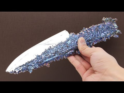
via https://www.facebook.com/492790024204140/posts/1266210603528741/
色彩好特別😍
#不是菜刀
via Bala
※ 編輯: Ctea 時間: 2019-06-13 21:16:49
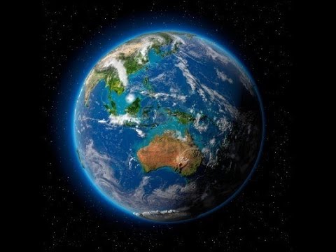
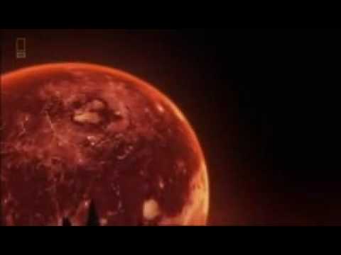
The Story of Earth Official Trailer #IMAX
https://www.youtube.com/watch?v=t-uXllFKvHA
[December Media] This is the story of a remarkable planet, unlike any other we know.
Born from dying stars, it was sculpted by violent collisions in space. Yet this hostile ball of molten rock was destined to transform itself into a nurturing environment that gave birth to life forms that have not been found anywhere else in the universe.
That planet is not millions of miles from where you are. It is the planet you are on right now.
Earth story. Our planet, our story.
The Story of Earth releases March 2018 and is available in IMAX Digital, IMAX Laser, and IMAX 1570 2D Flat Screen and Dome.
The Story of Earth IMAX Vox Pop
https://www.youtube.com/watch?v=-1Jzd0qT1Oc

https://www.tam.gov.taipei/News_Cont...FA747&sms=FD440F31D7871E16
臺北市立天文科學教育館-宇宙劇場-宇宙劇場 地球的故事 The Story of Earth
放映日期:109年7月1日至110年6月30日
片長:約40分鐘
「地球的故事」是一部由澳大利亞製作的實景拍攝影片,以現代地質學的角度引領我們探索地球。本片由Russell Scott執導,在澳洲和冰島等多地取景,由澳洲攝影協會金獎攝影師Benjamin Cunningham親自掌鏡,並藉著地質學家Martin Van Kranendonk的探勘旅程,引領我們探索地球與生命的起源。 地球起源於太空中的某處,藉由恆星的死亡與新生,行星的形成與撞擊,在生生不息的宇宙詩篇中我們獨一無二的地球誕生了,早期熔融狀的地球隨著時光的流逝逐漸演變為現今能孕育生命的水藍星球,影片內容包括地磁、地幔、地殼、板塊、火山、大氣層等,內容豐富,適合闔家蒞臨觀賞。
https://www.youtube.com/results?search_query=The+story+of+Earth+imax
The Story Of Earth And Life - Full Documentary- Blue Planet
https://www.youtube.com/watch?v=5e0hrstSn_I
National Geographic The Story of Earth HD
https://www.youtube.com/watch?v=z5VKVASx7Xs
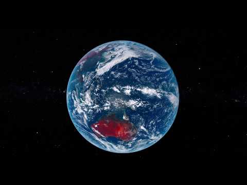
Planet Earth(Our Home) Space View Day/Night | Beautiful Planet Video 4k - YouTube
https://www.youtube.com/watch?v=p3f0SOkTl-M

※ 編輯: Ctea 時間: 2020-07-23 18:12:55 (台灣)
Go Beyond the Science & Explore the Beauty of the Earth with Bob McDonald - YouTube
https://www.youtube.com/watch?v=CSDziQGA0jg&t=216s

※ 編輯: Ctea 時間: 2020-07-23 18:13:51 (台灣)
https://en.wikipedia.org/wiki/Badwater_Basin
https://zh.wikipedia.org/zh-tw/惡水盆地
惡水盆地(Badwater Basin)是位於加利福尼亞州因約縣死亡谷國家公園的一個內流盆地,前身是全新世時期的曼利湖(Lake Manly)。海拔高度為-86公尺(-282.2英尺),因而成為北美洲的最低點。
#惡地地形
※ 編輯: Ctea 時間: 2020-07-27 15:55:34 (台灣)
https://en.wikipedia.org/wiki/Ribbon_lake
Ribbon lake
#冰河地形
via https://en.wikipedia.org/wiki/Llyn_Ogwen
via https://en.wikipedia.org/w/index.php?title=Lady_of_the_Lake&oldid=978149699#The_Lady's_lake
The Lady's Lake
#湖中女神
※ 編輯: Ctea 時間: 2020-09-20 21:13:08 (台灣)
https://en.wikipedia.org/wiki/Probability_of_precipitation
Probability of precipitation
某一特定時間地點會出現高於某一門檻的降水量的機率。
女子活了30幾年才發現降雨機率的真正意義,結果釣出多位氣象專家回應
https://www.youtube.com/watch?v=6_5EBdPAV4Q&feature=emb_title

2021/02/23(Tue)
22:58
Jim
https://forgetfulbc.blogspot.com/2021/02/rain.html
22:59
Jim
靠北。原來降雨機率是「降雨在該區域的覆蓋率」而不是「該地區會不會下雨的機率」
23:00
Jim
[Sticker]
- - - -
事件後續:
這部影片瘋傳後,有一位網友在影片底下留言反駁:「妳錯了,『降雨機率30%』的意思的確是有30%的機率會下雨。我爸曾經是資歷30年的氣象學家。」但這位網友馬上被另一位專家網友打臉:「我的現職是氣象學家,她(影片上傳者)講的沒錯,妳爸是錯的。氣象預報的意義在於預測該區人口中會有多少比例的人看到降雨。」
她事後又上傳了以下的影片,表示她看了許多美國氣象專家的回應後,得到的結論是在「一週氣象預報」中,第一天和第二天的降雨機率確實是在預測「降雨在該區域的覆蓋率」(如果降雨機率是40%,代表該降雨會覆蓋該區域的40%,代表有40%的人口會看到降雨),準確度也很高,但第五天到第七天的預報準確度不太高,只能做為參考。(請留意此為美國的降雨機率定義方式,各國氣象局的降雨機率定義方式,可能隨地域條件不同或算法不同而有所差異。)
- - - -
23:00
aria
[Sticker]
23:02
ygr
操作型定義
23:02
ygr
至少台灣的定義還是下雨的可能性
23:02
ygr
氣象常識 | 交通部中央氣象局
https://www.cwb.gov.tw/V8/C/K/Encyclopedia/nous/index.html#introduction-06
``例如預報台北市降水機率70 %,就是指有7成的機會在台北出現降雨。``
23:04
Jim
[Sticker]
2021/02/24(Wed)
13:45
Nn
原來如此(?
13:45
Nn
咦咦咦
13:45
Nn
降雨機率自助餐
via FTB
※ 編輯: Ctea 時間: 2021-02-27 06:31:45 (台灣)
https://www.cwb.gov.tw/V8/C/W/OBS_Radar.html?Tab=0&oa5fyb
雷達回波 | 交通部中央氣象局
#工具網站 #天氣 #氣象
※ 編輯: Ctea 時間: 2021-03-24 08:15:29 (台灣)
> https://www.plurk.com/p/obmsbf
https://www.ptt.cc/bbs/TY_Research/M.1618742982.A.01E.html
天氣小觀:這時節竟...西北太平洋春颱共伴
#共伴效應 #颱風
※ 編輯: Ctea 時間: 2021-04-20 12:23:08 (台灣)
https://commons.wikimedia.org/wiki/File:Lightning_over_Tulsa_cropped.jpg
#Tulsa #閃電 #春雷 #春季
※ 編輯: Ctea 時間: 2021-06-18 18:26:09 (台灣)
https://www.facebook.com/dennis110110110911097341554/photos/1460471380705309
【全方位氣象資訊】 氣象不準? 說出研究員心聲
那幾次當氣象預報失準的時候
#大氣 #氣象
※ 編輯: Ctea 時間: 2021-07-27 16:49:51 (台灣)
https://terms.naer.edu.tw/search/?q=erratics&field=ti&op=AND&group=&num=10
#漂石
https://en.wikipedia.org/wiki/Glacial_erratic
Glacial erratic
via https://en.wikipedia.org/wiki/Acadia_National_Park#Bedrock_formation
Acadia National Park
#冰河地形 #不是玄武岩 #Otter Cliff #Maine緬因州
tterCliff_1920x1080.jpg
※ 編輯: Ctea 時間: 2021-07-31 05:27:44 (台灣)
https://www.facebook.com/143014666130296/posts/1479458589152557/?app=fbl&5t2svbay
[Geomorphological Features] Left: A 1944 map by geologist Harold Fisk charts a 40-mile stretch of the Mississippi River from Friars Point to Gunnison, Mississippi. Fisk used aerial photos and maps to estimate the past and then-present channels. Right: By comparison, a map created using lidar shows shifts over the past 75 years. Erosion and changes in flow caused the channel to widen in the middle of the image and migrate toward the south.
Source: https://www.nationalgeographic.com/s...den-history-uncovered-by-lidar
See the Mississippi River's hidden history, uncovered by lasers
#地質 #地形學 #地形圖 #等高線 #老地圖 #老書籍 #密西西比河 #隱藏的歷史
My Notepad, [17/04/2022 19:38]
※ 編輯: Ctea 時間: 2022-04-17 23:45:22 (台灣)
https://www.facebook.com/240654819299597/posts/5387374191294275/?app=fbl&4xevw7nm
【臺灣國定古蹟編纂研究小組(National Historic Monuments of Taiwan)】 added a new photo to the album 日治時期臺灣地質寫真之惡地地域侵蝕作用舊照.
日治時期臺灣地質寫真之惡地地域侵蝕作用舊照
#地質 #惡地 #日本時代 #老照片
My Notepad - NEWS, [11/04/2022 14:09]
※ 編輯: Ctea 時間: 2022-04-17 23:47:53 (台灣)
https://en.wikipedia.org/wiki/Last_Glacial_Period
https://en.wikipedia.org/w/index.php?title=Last_Glacial_Period&oldid=1112694944
Other areas of the Northern Hemisphere did not bear extensive ice sheets, but local glaciers were widespread at high altitudes. Parts of Taiwan, for example, were repeatedly glaciated between 44,250 and 10,680 BP as well as the Japanese Alps.
#上一次冰河期 #台灣冰河地形相關
https://en.wikipedia.org/wiki/Japanese_Alps
Japanese Alps
#日本阿爾卑斯
※ 編輯: Ctea 時間: 2022-10-07 09:51:14 (台灣)
https://twitter.com/tyomateee/status/1579809313186795521
【最多情報局】崖から落ちた氷山が勢いで沈むかと思いきや、氷山の密度が低く海水が重いので瞬時に再浮上して水面に浮かび上昇し続け柱となる氷山の一角、これは圧巻の光景だ…
p0vduh 冰山崩潰一景
※ 編輯: Ctea 時間: 2022-11-05 16:10:14 (台灣)
https://www.youtube.com/watch?v=Hm6AOHq9OL4
Cunk on Earth 🤣 Trailer - BBC

網飛上了扯淡地球史,演算法覺得特別適合我,不斷狂推。
果然很北七,但看了兩集忽然充滿正能量,遇到無厘頭仍能正常發揮是否才是真強者!
有幾個學者即使遇到很不妙的問題,還能夠用自己的專業把問題導向一本正經的科普,實在太了不起了。
- 我真的很喜歡這系列,扯淡英國史也超級好笑XD
- 英國腔真的很適合這種節目
#歷史人文 #地球史
※ 編輯: Ctea 時間: 2023-02-02 23:43:59 (台灣)
※ 編輯: Ctea 時間: 2023-02-26 14:43:52 (台灣)
My Notepad, [12/10/2023 10:34]
https://en.wikipedia.org/wiki/Absheron_gas_field
Absheron gas field
via https://en.wikipedia.org/wiki/Apam_Napat#'Swamp_gas'_conjecture
https://en.wikipedia.org/w/index.php?title=Apam_Napat&oldid=1153805527
Based on the idea that this fire-from-water image was inspired by flaming seepage natural gas, attempts have been made to connect the name "Apam Napat" to the word "naphtha", which passed into Greek – and thence English – from an Iranian language.
However, there is only a modest amount of evidence for a link between the sacred fires of Iranian religion and petroleum or natural gas – although the account of the blowing of the 3 sacred fires out to sea from the back of the ox Srishok where, unquenched, they continue to burn on the water is suggestive – particularly in relation to hydrocarbon deposits in the Southwestern part of the Caspian Sea, exploited currently by the Absheron gas field near Baku in Azerbaijan.
#瓦斯 #天然氣 #甲烷 #亞塞拜然 #水中之火 #印歐神話水中火
※ 編輯: Ctea 時間: 2023-10-12 11:30:09 (台灣)
https://en.wikipedia.org/wiki/Air_mass
Air mass
https://en.wikipedia.org/wiki/Cold_wave
Cold wave
https://en.wikipedia.org/wiki/Siberian_High
Siberian High
#寒流 #大陸冷氣團 #蒙古高壓 #西伯利亞高壓
#日記 mentioned earlier
※ 編輯: Ctea 時間: 2024-01-11 23:52:24 (台灣)
※ 編輯: Ctea 時間: 2024-03-04 15:23:58 (台灣)
2024-3-26 08:47
https://www.facebook.com/mdc.cwb/post...WFjvyJaA19kh2hLHc7MgqicpwwyVTl
鋒面尾巴影響!
雨區很有限,衛星雲圖可以看到明顯的「雲線」,海面上對流雲比較明顯,陸地上地形影響雲量分布,也影響雨區,雨量並不太!
#氣象 #大氣 #衛星雲圖判讀 #與那國島 #大雨 #氣象局長
※ 編輯: Ctea 時間: 2024-03-26 23:27:10 (台灣)
https://en.wikipedia.org/wiki/Bog
https://en.wikipedia.org/wiki/Peat
https://en.wikipedia.org/wiki/Blackwater_river
#Blacwater river黑水河 #沼澤 #泥炭 #煤炭 #酸沼 #濕地
※ 編輯: Ctea 時間: 2024-03-28 23:39:20 (台灣)
※ 同主題文章:
03-15 21:20 □ [筆記] 689真的不是真的「有病」就能一言以蓋的
… ×266
02-19 18:13 Re [筆記] 屬猴的音樂家 by 台北愛樂:音樂線上
02-26 18:06 □ [筆記] 音樂文化與音樂文創 by 台北愛樂:早安,愛樂!
02-26 18:07 □ [筆記] 音樂家玩音樂 by 台北愛樂:音樂線上
02-26 18:09 □ [筆記] note Google Search: 石英 矽土 矽酸 矽質 地質 礦物 矽藻
● 02-26 18:09 □ [筆記] note Google Search: 地質 礦物 地球科學 環境 地形 冰河 天氣 氣象 泥沼
02-26 18:11 Re [筆記] note = #勒索綁架惡意軟體 #英國 #女性權益 #生理假 #身材歧視
02-26 18:12 Re [筆記] note 001s #礦物
03-04 18:35 □ [筆記] note Google Search: 全球暖化與冰河消長 #氣候變遷 #環境議題
… ×1782
※ 看板: CityNight 文章推薦值: 0 目前人氣: 0 累積人氣: 150
回列表(←)
分享